Antarctic Field Work - 2025/26
In December 2025, we started fieldwork on an NSF-funded project to study the Ice Rumple Zone of the McMurdo Ice Shelf, Antarctica. The Rumple Zone is a compressive region of the ice shelf characterized by undulating ice. Over the next several weeks, we will perform Terrestrial Radar Interferometry (TRI), Autonomous Phase-sensitive Radio Echo Sound (ApRES), and Ice Penetrating Radar (IPR) to characterize the surface, englacial, and subsurface of the McMurdo Ice Shelf in this region. We will compliment these measurements with observations from Automatic Weather Stations (AWS), Global Navigation Satellite System (GNSS; aka GPS), seismometers, and time-lapse camera observations to fully characterize dynamic variations within the Rumple Zone. Follow along here for a summary of our work.
Jan 1, 2026
Happy New Year from McMurdo! 🥳 🎉 Busy few days on the hillside and iceshelf, so a bit late posting. Here are a few updates over the last few days, including a new movie of Rumple images from “Wall-E”, GPR profile samples, a snippet of AWS data, and a 9-hour time-lapse of TRI images. Check it out!
Movie created from time-lapse imagery: movie credit Michela
Here is a fun little movie created from time-lapse imagery from our Cyclapse camera (aka. “Wall-E”). It shows images taken every 30 minutes between Dec 20-31. You can see that working at this southerly latitude (77ºS) has its benefits - constant sunlight. The sun moves in a circle in the sky throughout the day but will not set again until Feb 20 (at 1:28 am!). The vehicles in the foreground are travelling on an ice road that transitions onto the rock of Ross Island. Note, the vertical motion of the ice shelf throughout the scene due to tides; nearly the entire scene moves vertically, except the bedrock in the lower left corner. See if you can spot the photo bomb by Field Santa Ali 🧑🏻🎄
GPR with Iceberg Allie
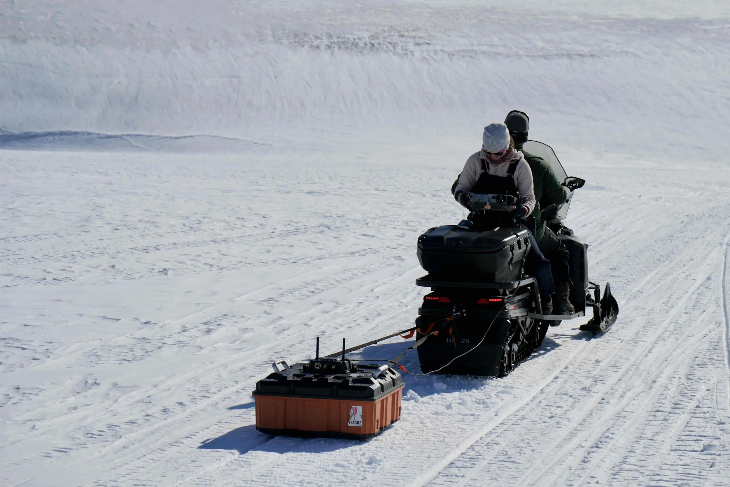
The team has been collecting GPR data of the ice shelf sub-surface. For most of the ice shelf, the team works in pairs to pull the GPR antenna behind a snow machine. One person drives the snow machine at a slow, constant speed, while another observes the data from a tablet. The observer is looking at the ice shelf stratigraphy; that is, layering in the firn (i.e. old snow) and ice beneath the surface. For the heavily crevassed Rumple crests, the team works in groups of 4 with Field Safety personnel. The field safety personnel pick a safe route, while two others navigate the GPR – one pulling in front, one pulling from the back, and a third person monitors the subsurface stratigraphy on the tablet.
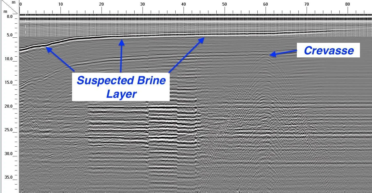
A *preliminary* scan down a trough with the ice shelf front towards the right of the image. The plot shows the ice shelf stratigraphy as subsurface depth (vertical axis) and distance along the profile (horizontal axis). A couple of interesting features are evident. A bright horizontal layer appears beginning ~8 meters depth and shallows to ~2 meters depth at ~80 meters along the profile. This is a suspected brine layer – a salt rich firn layer and/or salt-rich meltwater layer. The second interesting feature is the parabolic shape ~10 m deep and 60 m along the profile; this is a crevasse. We will use GPR data on the brine layer, crevasses, and potentially folds in the ice to understand the dynamics driving Ice Rumple evolution and stability.
Time-lapse of TRI data showing accumulated deformation
The time-lapse below is a 9-hour compilation of accumulated deformation from the TRI using the same geometry in the Dec 20 blog. It is comprised of 270 images acquired every 2-minutes and played chronologically; the date and time of each image appears in the upper right corner. Each color cycle (magenta-to-yellow pattern) represents 8.5 mm of motion; the more color cycles in the scene, the greater the accumulated motion. Most of the deformation is due to ice flow and ocean tides. Note the change in the color cycle pattern between the early images and later scenes. Initially, most of the motion is uniform; that is, both the sea ice and the ice shelf move towards the radar, which is in the bottom center of the scene. However, about halfway through the record (~6 secs in the movie), the pattern in the sea ice starts to change as the tidal motion of the sea ice is forcing the sea ice away from the ice shelf cliff. Meanwhile, the flow in the Rumples is still towards the TRI, demonstrating the compressional strain the region there, and the ice shelf in the far-field (top of the scene) shows ice flowing towards the sea ice in the general flow pattern for the ice shelf, not towards the rumples or the radar. Ultimately this data will be processed and analyzed to measure variations in ice shelf elevation and in the strain rates in the ice shelf, sea ice, and the Ice Rumples.
AWS
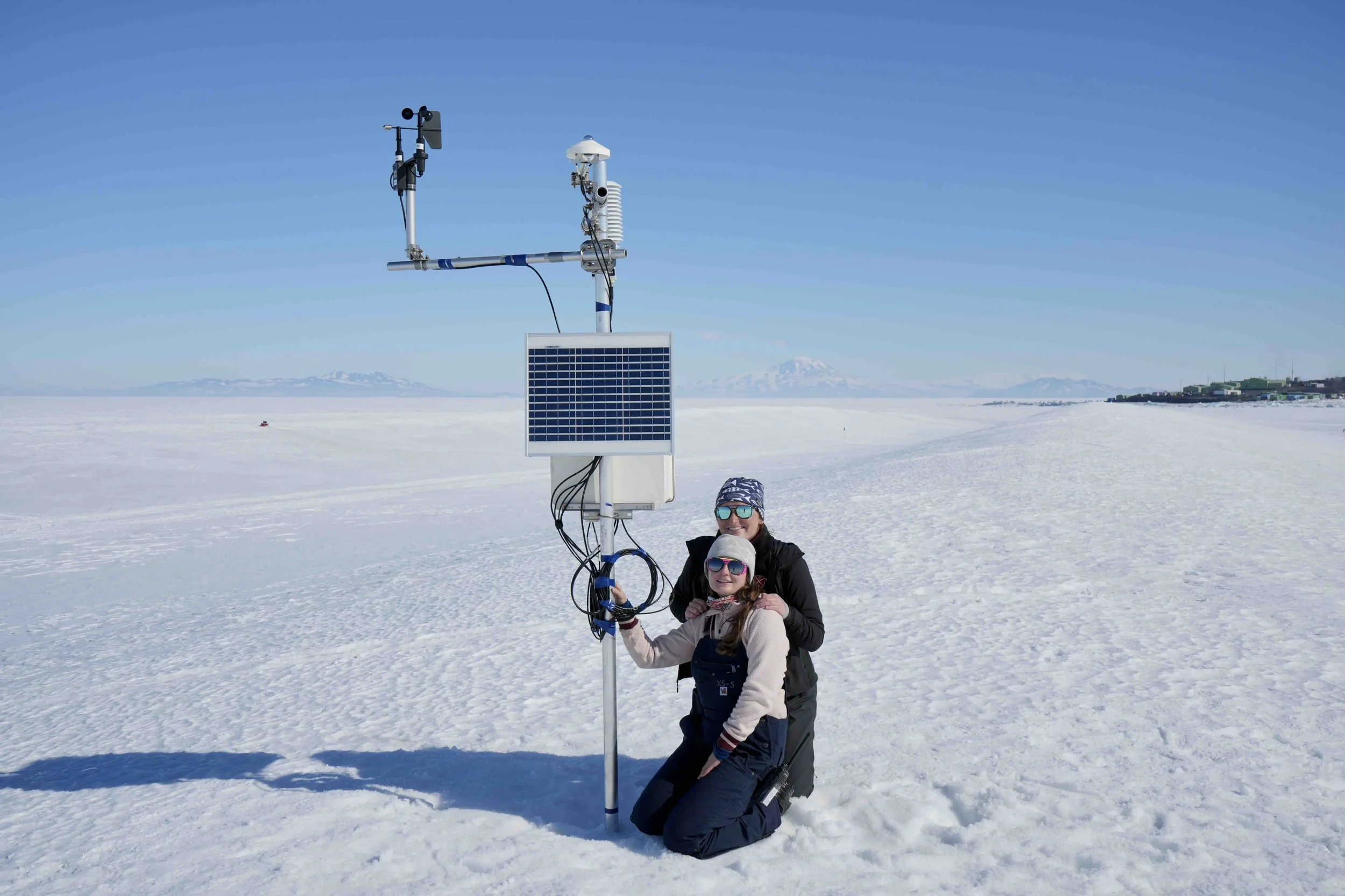
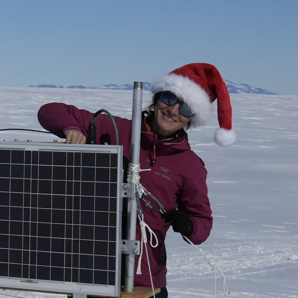
Iceberg Allie and Tech and Snowpit Extraordinaire Michela admiring the fruits of their labor with the AWS station.
Our two Automatic Weather Stations (AWSs) are up and running; one on a rumple crest and one in a trough. They have been collecting data over the past week and will continue to monitor changes in local atmospheric conditions over the next year. Some differences are evident between the crest and trough of a rumple.
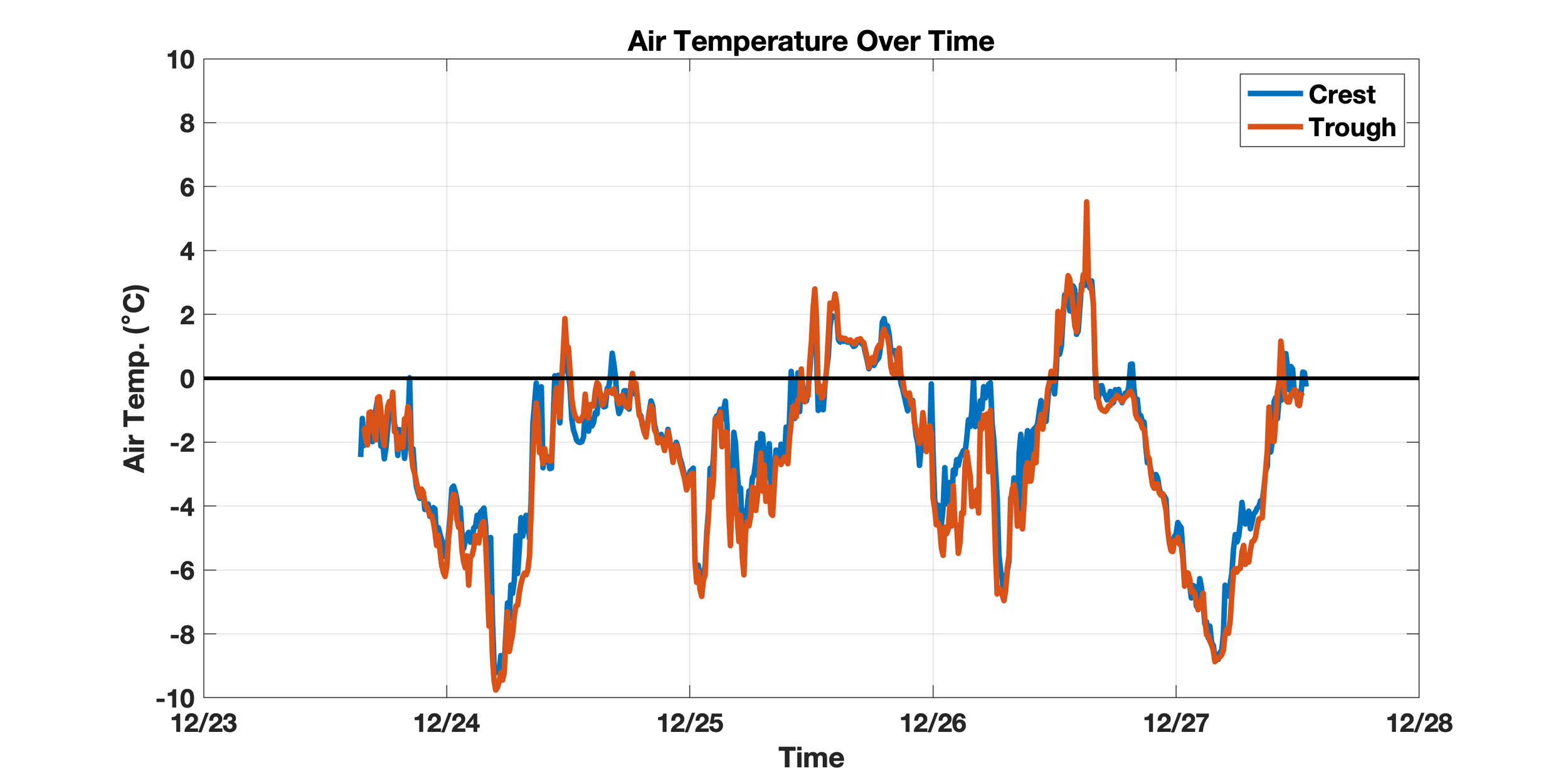
Air Temperatures: Overall temperatures in the Rumple Zone are below freezing for the short record so far. Despite the 24-hour sunlight here, the temperatures fluctuate diurnally – meaning the warmest temperatures generally occur during the day and cooler temps at night; this is due to the sun’s angle in the sky throughout the day. Temperatures are also generally consistent between the crest (blue) and trough (orange); however, the crest tends to warm earlier in the day. This is because the trough sensors are, at times, shadowed from the sun’s angle in the sky from the height the rumple crests; thus, experience a delay in surface warming.
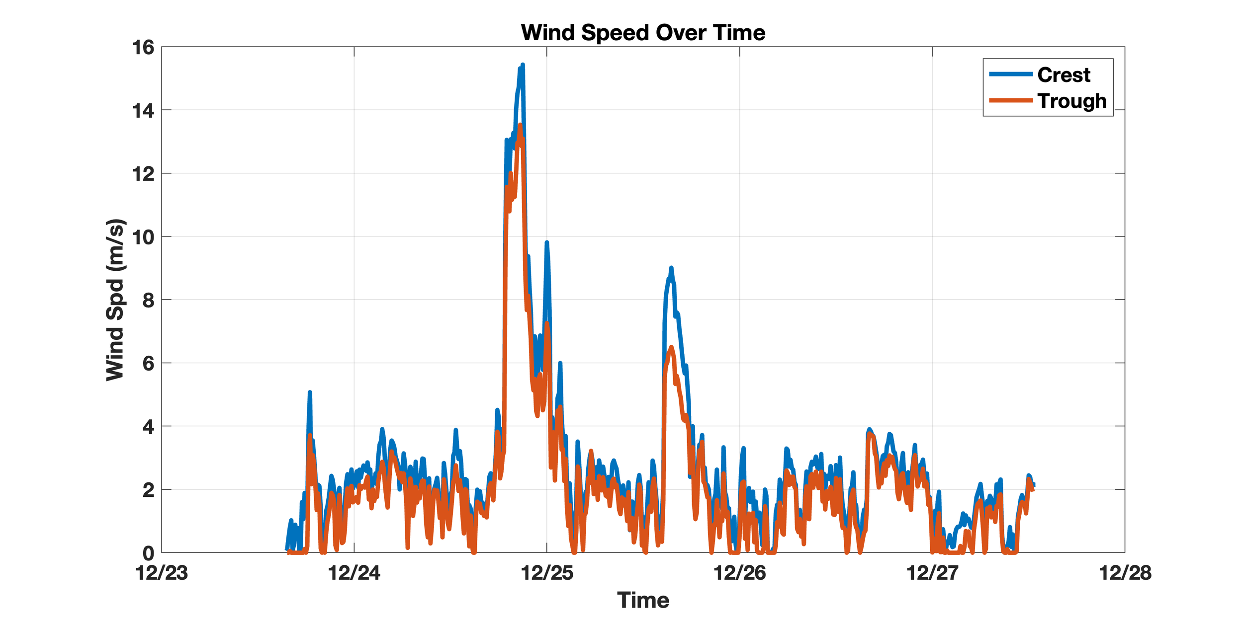
Wind speeds between the crests and troughs also track consistently. The undulating surface provides a small buffer from the wind in the troughs as opposed to the exposed surface along the crests. As anyone on our team can attest, one can definitely feel the difference in wind speed when working on top of the crests vs the rumple troughs.
Dec 26, 2025
Taking a break from field measurements to celebrate the holiday, so we decided to take a moment to introduce the field team. Short bios are provided below for a little background.
Dr. Ali Banwell - Field Team PI
Ali (aka. Field Santa) is a glaciologist who holds dual appointments as a Research Scientist in the Cooperative Institute for Research in Environmental Sciences (CIRES), University of Colorado Boulder, and as a Professor in the Centre for Polar Observation and Modelling (CPOM) at Northumbria University, UK. This is her seventh deployment to Antarctica, and she has also carried out fieldwork in Greenland, Svalbard, the Himalayas, and the European Alps. Ali is the CU Boulder PI and overall fieldwork lead for this project. She brings particular expertise in GNSS, automatic weather stations, and time-lapse photography, and leads the project’s satellite remote-sensing component.
Dr. Ryan Cassotto - Field Team Co-PI
Ryan (aka. Penguin Ambassador) is an Assistant Research Professor in the Climate Change Institute at the University of Maine and a Research Scientist in CIRES at the University of Colorado. A glaciologist by training, he uses remote sensing observations to study near-surface geophysical changes due to glacial flow, permafrost degradation, plate tectonics, wildfires, landslide motion and slope instabilities. He is a Co-PI on the NSF Rumples Project where he is leading the TRI measurement campaign, assisting with the GPR and ApRES measurements, and compiling satellite-based data to complement our ground measurements in McMurdo. This is Ryan’s first trip to Antarctica; however, he has conducted several field campaigns in Greenland and Alaska over the last 16 years.
Allie Berry - UMaine PhD Student
Allie (aka. Iceberg Allie) is a PhD student in the Climate Change Institute at the University of Maine. Doing good for the Earth is her main passion and priority. She's interested in ice-ocean interactions, like how melting land ice changes the physical properties of the ocean. She uses this information to improve Earth system models, which are valuable tools for climate predictions. On the rumple project she's in charge of the GPR and making sure everyone brings good vibes.
Michela Savignano - CU PhD Student
Michela (aka. Tech and Snow Pit Extraordinaire) is a PhD student in the Cooperative Institute for Research in Environmental Sciences (CIRES) at the University of Colorado Boulder. Her research focuses on ice shelf stability and how it is impacted by increasing surface melt. She uses both optical and lidar remote sensing data to study these changes and is interested in how they will impact global sea level in a warming world.
On the rumple project, Michela is in charge of making really awesome GoPro time-lapse videos (this blog), taking care of Wall-E (our other time lapse camera), tech support (obviously), digging gigantic holes in the snow (see photo), and any and all other miscellaneous tasks.
Dec 24, 2025
Today we split up into two teams – one to acquire TRI data from the hillside above the Rumples and another to check on the GNSS and AWS instruments in the Rumple Zone. We will pause for the Christmas holiday but plan to return to measurements on the 27th…..stay tuned for more exciting updates! Happy holidays all!
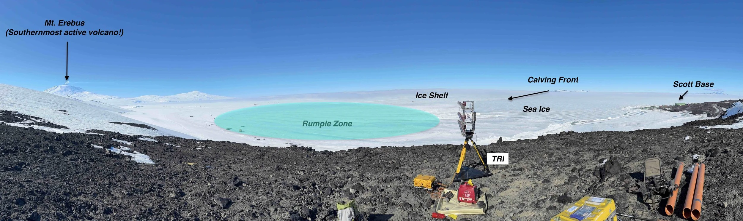
(Above) Panoramic view from the TRI site illustrating regions of interest. Although the evolution of strain rates within the Rumple Zone (cyan highlighted region) is a major priority in our investigation, we are also able to capture amazing radar and visual perspectives of the dynamic processes that occur along this ice-ocean boundary.
Dec 23, 2025
Over the last two days, we installed 2 Automatic Weather Stations (AWS), one on a rumple crest and another on an adjacent trough. These stations will measure air temperature, air pressure, wind speed and direction, incoming solar radiation, infrared radiation emitted from the snow/ice surface, and changes in snow/ice surface height. We also installed 2 time-lapse cameras – one for our field season and another that will winter over for the next year. Camera observations are useful for data interpretation and validation. They capture images more frequently than satellites and have more cloud free scenes, providing greater images for data validation.
A time-lapse of the AWS installation on a rumple crest. Pardon the progressive “sinking” of the camera frames. It was fairly warm outside (i.e. above freezing) and the cardboard box the camera was poised on melted into the snow on top of the rumples.
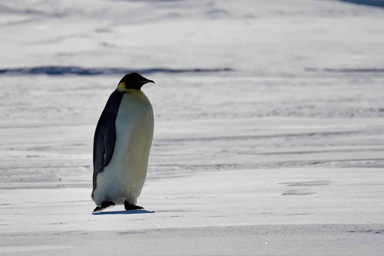
An Emperor Penguin local to our field site in the Ice Rumple Zone. Admiring these beautiful creatures in their native habitat never gets old. Photo credit: Ali Banwell
Dec 20, 2025
Today, UMaine PhD student Allie Berry and I started the TRI campaign. From our vantage point ~50 m above the ice shelf, we had a clear view of the Rumples, the sea ice and the ice shelf edge (also known as the ice shelf / sea ice transition), and many of the other features within the radar’s line of sight.
We used hunting packs to transport the TRI from the Scott Base Road to our field site ~0.5 km along a hillside full of basaltic scree. After configuring the TRI to a semi-permanent mount, Allie started acquiring measurements. This was her first time using the TRI and she handled it like a pro.
Credit to CU Boulder PhD student Michela Savignano who captured our setup and initial measurements in time-lapse.
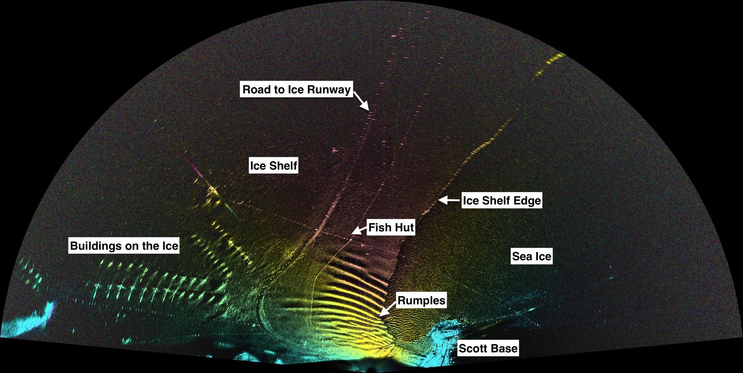
**Preliminary TRI Results** After some initial measurements, we settled on a 170-degree scan and an 8 km range. We acquired measurements every 2 minutes for one hour. The results, presented from an overhead view perspective, show excellent image quality of our target area with many critical features, including the undulating surface of the Rumple Zone and pressure ridges in the sea ice to the right of the rumples in the image. The colors represent 20 minutes of motion (~5-10 cm), likely due to flexure of the ice shelf due to ocean tides. The texture in the background image is the amplitude of the returned TRI signal, called backscatter.
Dec 19, 2025
Today was our first day in the Rumple Zone. We were accompanied by two members of the Field Safety and Training team (FS&T) who familiarized us with the icescape and the dangers therein. Like most glaciers, crevasses can be found in areas undergoing extension. In the Rumple Zone, the largest crevasses are located closest to the ice shelf front. The FS&T team marked these regions as areas to avoid so that we could conduct our science in a safe and responsible manner. We are beyond grateful to the entire FS&T mountaineering team who go through extraordinary lengths to mark these existing dangers in study areas before scientists ever step foot in the field. Their courage, skill, and dedication ensure the safety of our team and all the scientists here in McMurdo.
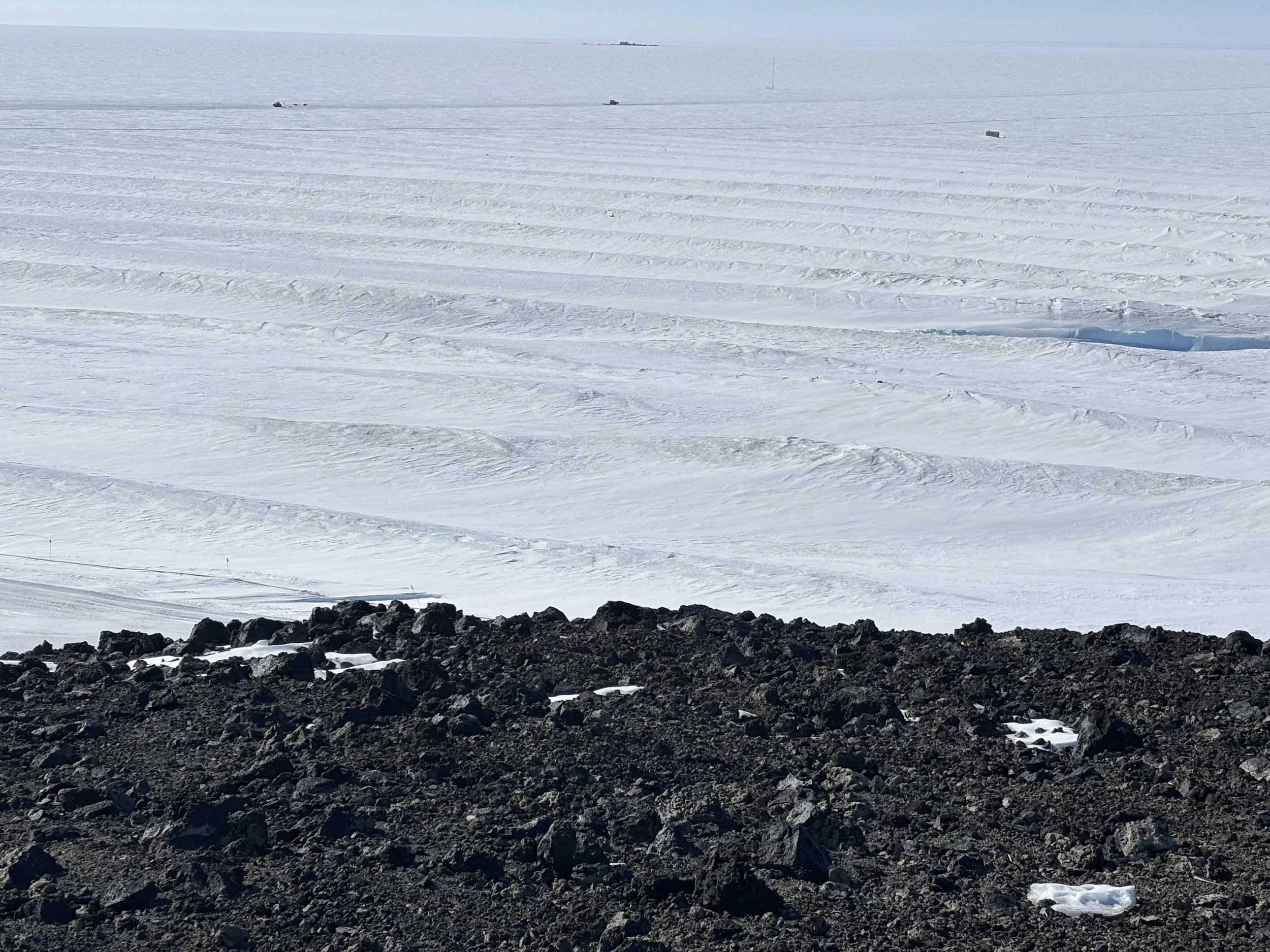
Figure: The undulated surface of the Rumple Zone. Notice, the crests and troughs as the ice “bunches up” under compression. The small building in the back is a mobile lab, much like an ice fishing shelter, that we use to stage our equipment and take a break from the wind
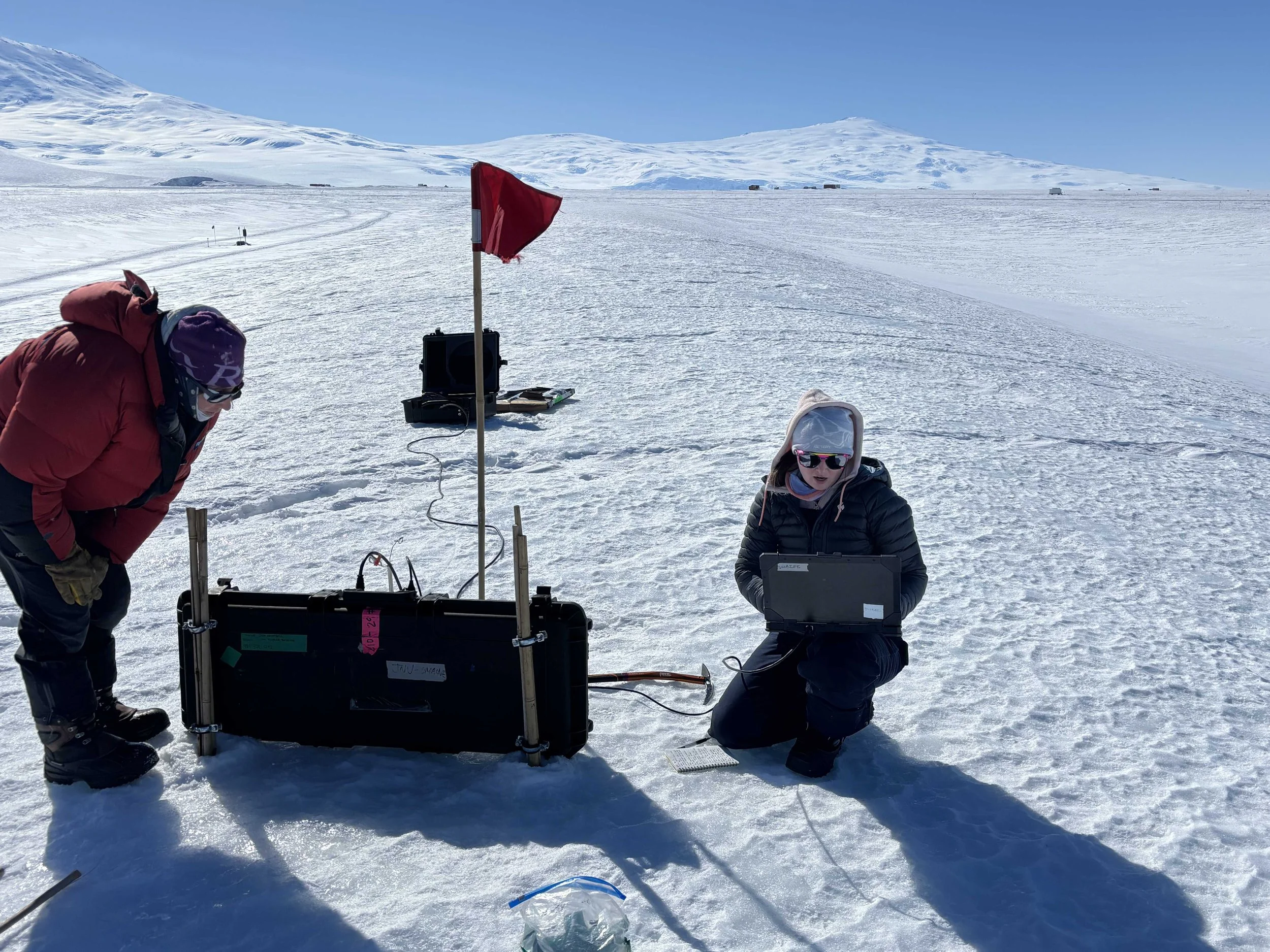
ApRES Installation
UMaine PhD student Allie Berry configuring the ApRES to conduct measurements within the ~30 meter thick ice shelf. Specifically, we are looking for changes related to englacial meltwater, englacial strain rates, and potentially the brine aquifer – a layer of cold saline water stored within the ice shelf.
As Assist by the FS&T Team
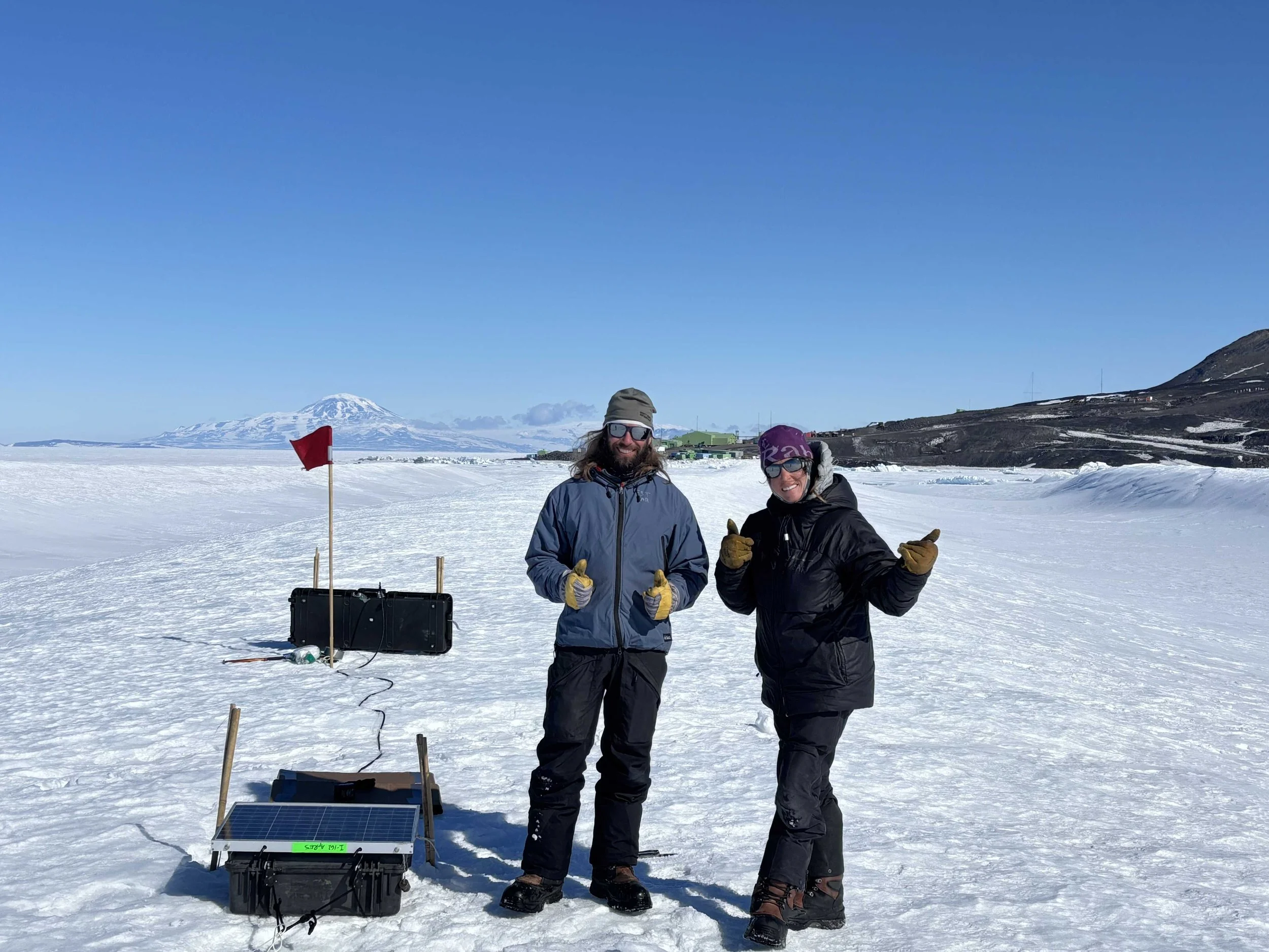
Special shout out to FS&T mountaineers Dylan (left) and Lauren (right) for guiding us safely through the Rumple Zone. Their expertise anchoring in snow/ice also comes in handy 🙂 for securing equipment to the ice shelf as shown here securing the ApRES battery box and solar panel using an ice anchor on top of a rumple crest.
Dec 18, 2025 - “Carp Ops” to the Rescue
After arriving in McMurdo, participants must complete several trainings before beginning field work. We completed no less than 10 such trainings including field safety and survival, multiple field risk assessments, VHF and iridium satellite phone communication, GPS training, working in and around helicopters, driving station vehicles, stove/heater training, and operating snow machines and PistenBulleys (aka. Snow groomers).
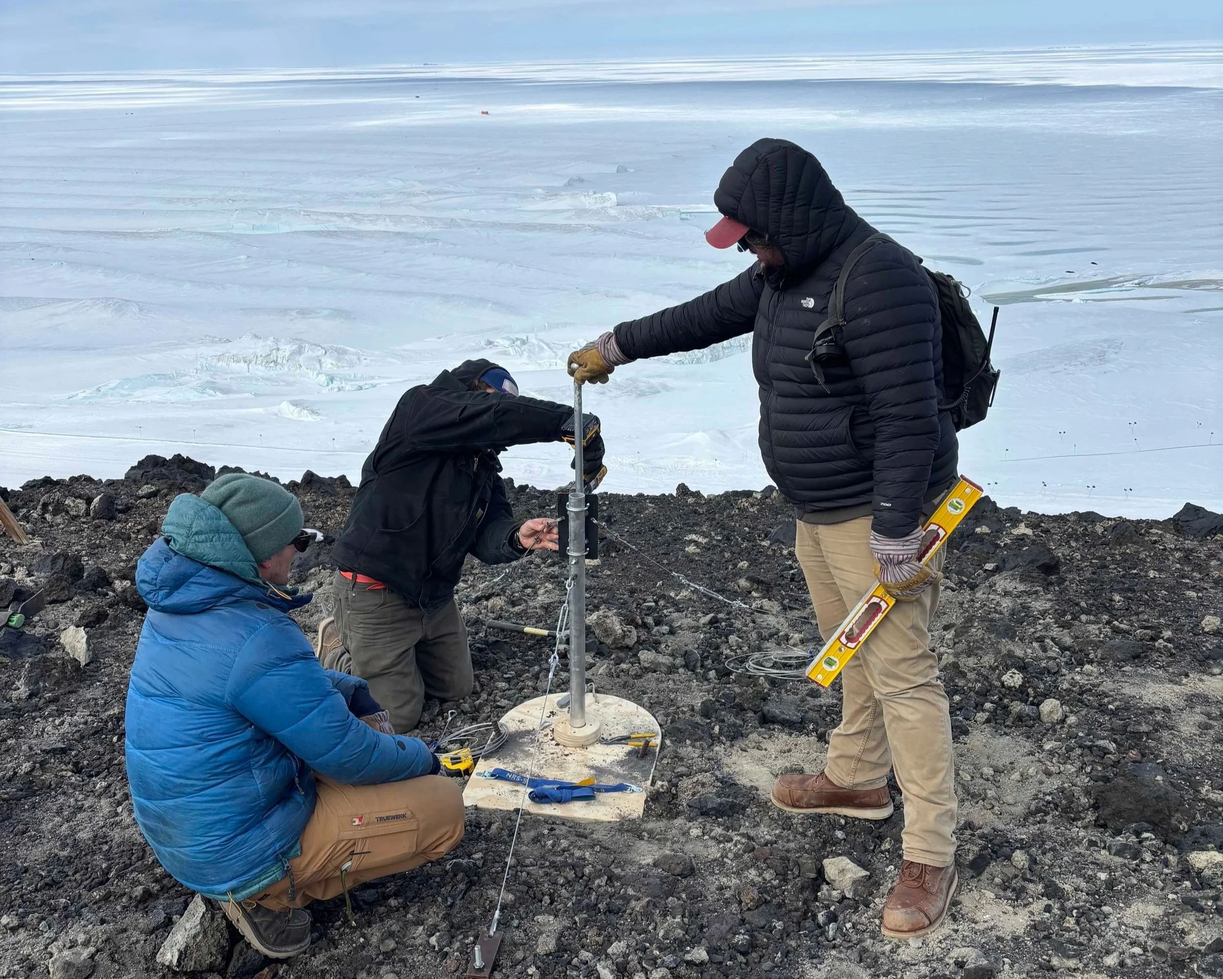
After a week of training and a few weather delays, we installed base stations for our TRI and time-lapse cameras on a hillside above the Rumple Zone. A major shout out to the very talented crew of Carpentry Operations or “Carp Ops” – particularly “Stitch” and Mark for building and installing these base stations. Their hard work has made our job so much easier – allowing us to focus on the science here in Antarctica.

Dec 8, 2025 - Touchdown!
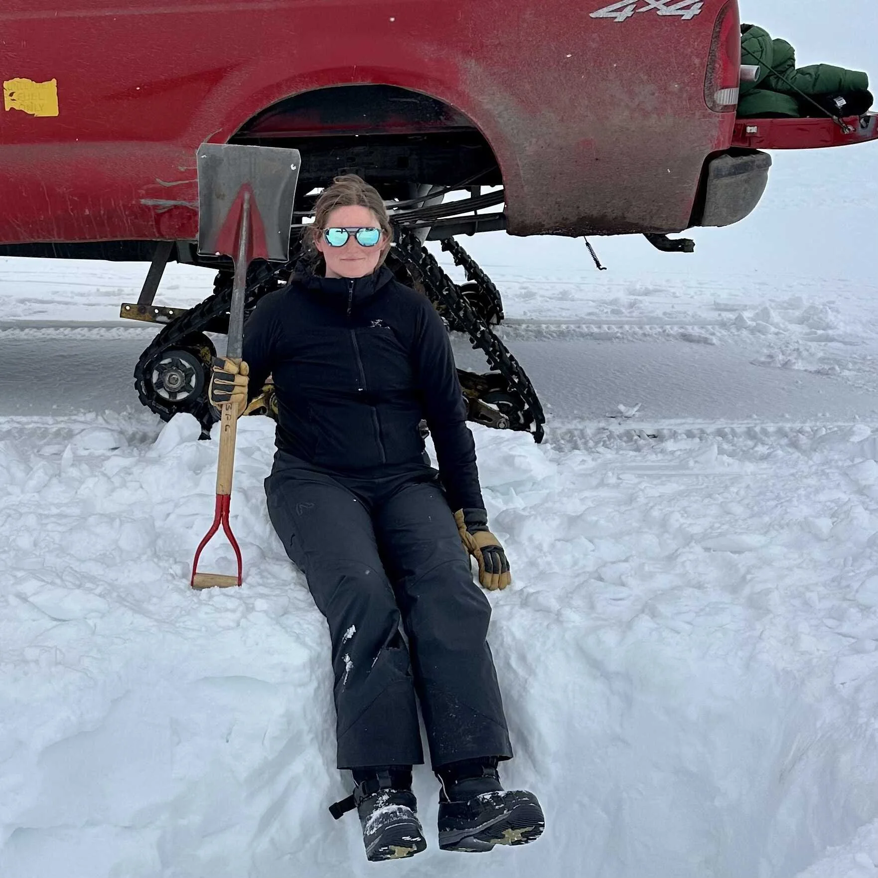
We arrived Dec 8 via an LC-130 (background). Our geophysical team from left to right: Ali Banwell (Field Team PI), Michela Savignano (CU PhD student), Ryan Cassotto (Co-PI), and Allie Berry (UMaine PhD student) posing with our NSF issued “Big Red” jackets, waiting to make the journey to McMurdo Station. We have been undergoing training and making preparations for field work scheduled to begin next week.
Penguin Count: 10 Adele Penguins
Seal Count: Dozens of Weddell Seals.

Dec 4, 2025: The McMurdo Ice Shelf
We recently started an US National Science Foundation collaborative project to study the Rumple Zone of the McMurdo Ice Shelf, Antarctica. In some areas - including our field site at the edge of the McMurdo ice shelf besides Ross Island - ice shelves are under compression, where the ice shelf is flowing over ocean towards land. In this environment, an ice shelf can crumple, forming topographic features in the ice shelf that look like rumples or waves. In the some cases, the glacier ice within these rumples can also buckle, forming fractures, orientated either perpendicular or parallel to the ice shelf flow.
The overall goal of our project is to determine how rumples affect ice shelf stability and hence ice shelf buttressing power, i.e. how much an ice shelf can slow the flow of grounded ice behind it. To do this, we first need to understand how the rumples evolve over time and the geophysical mechanisms governing their formation and stability.
This is a collaborative project between the universities of Chicago (PI Doug MacAyeal), Colorado-Boulder (PI Ali Banwell, me 🙂 Co-PI Ryan Cassotto), and Maine (PI Kristen Schild and Co-PI Seth Campbell).